H-GAC CRP Special Projects
In addition to routine ambient monitoring, Clean Rivers Program (CRP) funds have also been used to conduct special projects that help identify problem areas and collect additional data for assessment. The following is a list of special projects that have been funded by CRP since 2011.
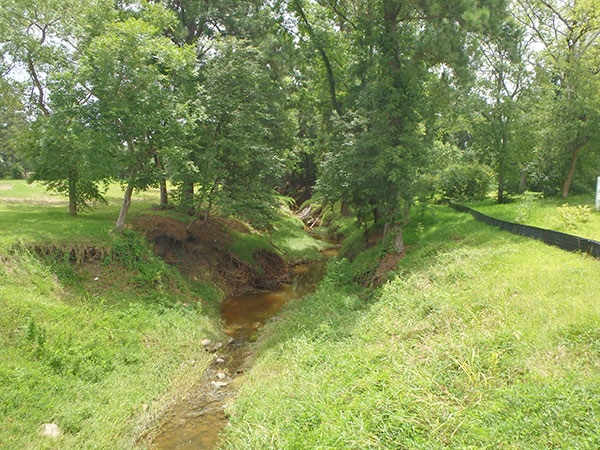
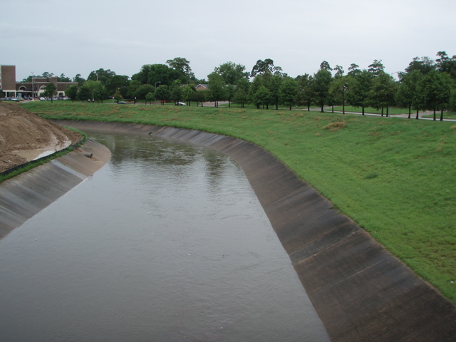
Applying the correct standards and screening criteria to each classified and unclassified segments being assessed is a major challenge. A water body that is a concrete lined ditch will not be evaluated in the same manner as a totally natural stream with defined bends, runs, riffles, and pools. Many questions about the shoreline, stream buffer, and canopy, as well as land use or land cover within the watershed upstream of each monitoring site must be answered to correctly assess each water body.
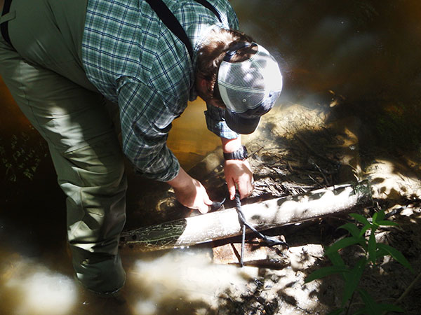
To gather this valuable information for TCEQ’s assessors, H-GAC initiated a project in 2009 to conduct habitat assessments at monitoring locations on the tributaries of Buffalo Bayou and the Houston Ship Channel. After the initial 60 characterizations were completed in 2011, H-GAC has continued to conduct between 5 and 10 habitat assessments every two years. Investigators look at the area immediately upstream of each monitoring location and then monitor the watershed at each sampling site to determine if there are any obvious sources of bacteria or other pollutants that may negatively affect the waterway. Pollutant sources identified during field work will to be reported to the appropriate agency or department for further investigation and correction. Removal of pollutant sources will help reduce the elevated bacteria and nutrient levels in area watersheds. To date, 72 site characterizations have been completed. Reports are available upon request.
H-GAC initiated 24-hour dissolved oxygen (DO) monitoring to verify or determine the extent of DO impairment at priority sub-segments within the region. During each CRP contract (2-year duration), H-GAC chooses six sites from which to collect 24-hour data.
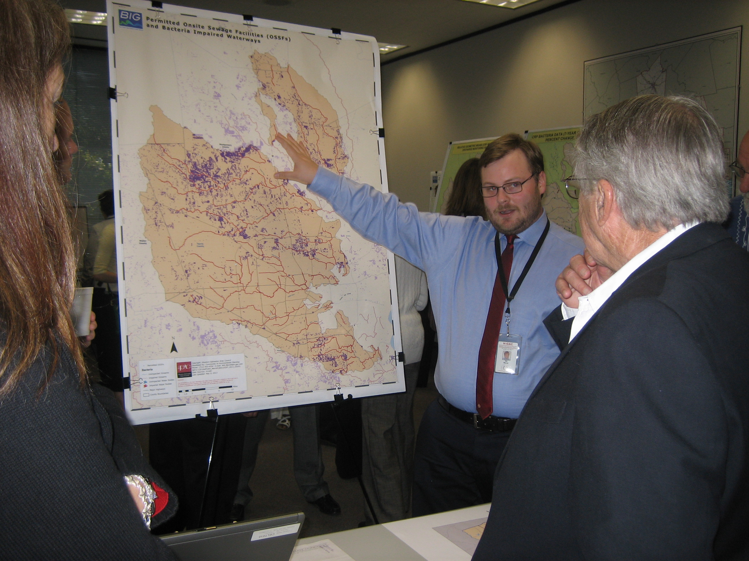
H-GAC completed an evaluation of existing nutrient and geospatial data relationships in 2013. This evaluation identified a potential relationship between land cover, land use, and ambient nutrient concentrations in select streams throughout the region. H-GAC staff identified 14 monitoring stations for inclusion in this analysis. Once the watershed was identified for each station, watershed characterizations were conducted and attributes were identified and assigned to all sub-watersheds. Attributes included:
- Land cover types
- Number of upstream wastewater treatment facilities (WWTF) with average permitted discharge (where available)
- Soil types (including hydrological soil groups)
- Drainage density and drainage area
- Basin relief (including minimum, maximum, and average elevation)
- Road density
- Imperviousness
Analysis of the data demonstrated the following:
- A weak, but statistically significant, relationship exists between nutrient concentrations and two land cover types: wetlands and forested area.
- Areas with more wetland and forest tended to have lower nutrient concentrations.
The University of Houston Clear – Lake Environmental Institute of Houston (EIH) completed two biological assessment events at 5 sites during the summer of 2011 and the final reports were completed in April 2013. These assessments were conducted to determine if biological conditions in the selected streams had changed significantly over the previous 12 years. The watershed of each stream had experienced significant population growth and development during this time period. During each assessment, fish communities, macrobenthic communities and physical habitat data were collected. The USGS conducted one monitoring event at each of the sites between 1997 and 1998. EIH conducted two monitoring events at each site with one event completed in May 2011 (the Index Period) and one event completed in July 2011 (the Critical Period). The 2011 assessments were compared to the 97-98 biological characterizations conducted by the USGS. All sites were at “above tidal” locations and included:
- 11120 Cedar Bayou near Crosby, Tx
- 11452 Clear Creek at SH 35 in Pearland
- 11467 Dickinson Bayou at FM 517
- 11367 Lake Creek near Egypt, TX
- 11245 West Fork San Jacinto River at IH 45
EIH found that all sites still met their assigned aquatic life use (ALUs) designations when using the more recent TCEQ-approved regionalized fish IBI methods but generally resulted in lower ALU values when compared to the previously used state-wide IBI method. The regionalized method uses an ecoregion approach, meaning it’s tailored to evaluate the health of the fish community in the basins served by H-GAC (versus comparing these fish communities to fish communities in the hill country or the panhandle, etc) . The complete reports can be found on H-GAC’s Water Resources web site.